
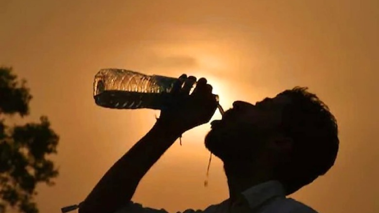
Hot weather conditions continued to prevail in many parts of north India including Delhi, Haryana, Punjab and Rajasthan on Tuesday, with Karauli in Rajasthan sizzling at 43.9 degrees Celsius. On the other hand, the intensity of rainfall is likely to increase over the west coast from July 9 due to a revival of the Southwest Monsoon, the India Meteorological Department (IMD) has said.
The mercury in the national capital settled at 40 degrees Celsius, with low humidity in the air. The relative humidity was recorded at 34 per cent, according to the IMD.
On Monday, the minimum and maximum temperatures in Delhi had settled at 28 degrees Celsius and 39.5 degrees Celsius respectively. According to the IMD website, the national capital's maximum temperature was recorded at 40 degrees Celsius on Tuesday evening.
The minimum temperature recorded at the Safdarjung Observatory, considered to be the official reading for the city, was 32.8 degrees Celsius in the morning, with a relative humidity of 54 per cent. Hot weather conditions continued to prevail in Haryana and Punjab, with Gurugram sizzling at 42.6 degrees Celsius.
Gurugram, where the maximum temperature was five notches above normal, was the hottest place in Haryana. Among other places in Haryana, Hisar recorded a high of 41.5 degrees Celsius, three notches above normal, while Narnaul and Bhiwani recorded a maximum temperature of 41.2 degrees Celsius and 41.4 degrees Celsius respectively, according to the IMD.
Ambala recorded a high of 39.7 degrees Celsius, four notches above normal, while Karnal's maximum temperature settled at 38.8 degrees Celsius, also four notches above normal. In Punjab, Bathinda recorded a high of 40.2 degrees Celsius, three notches above normal, and Patiala recorded a maximum temperature of 40.6 degrees Celsius, five notches above normal.
Amritsar recorded a maximum temperature of 40.3 degrees Celsius, four notches above normal, while Ludhiana's high settled at 38.2 degrees Celsius, three notches above normal. Chandigarh, the common capital of the two states, recorded a high of 39 degrees Celsius, four notches above normal.
Light to moderate rainfall occurred in some parts of Rajasthan in the last 24 hours with the maximum of 6 cm recorded in Ajmer's Rupangarh and Banswara's Danpur. Mangaliawas (Ajmer) and Kanwas (Kota) recorded 5 cm rainfall each. Jamwaramgarh (Jaipur) recorded 4 cm rainfall while a few more places recorded below 4 cm rains.
Karauli was the hottest place in the state with a maximum temperature of 43.9 degrees Celsius. The day temperature in Dholpur, Sriganganagar, Pilani and Jaisalmer was 42.6 degrees Celsius, 42.4 degrees Celsius, 42.3 degrees Celsius and 40.2 degrees Celsius respectively, according to the IMD.
The northern limit of the Southwest Monsoon is constant in Barmer, Dholpur and Bhilwara districts and it has not advanced further for the last several days because of unfavourable weather conditions. The monsoon is likely to activate in the remaining parts of Rajasthan after July 10 if the conditions are favourable, according to a forecast.
Meanwhile, as models forecast a revival of the Southwest Monsoon after a break, the intensity of rainfall over the west coast is likely to increase from July 9, the IMD said on Tuesday. However, the intensity of rainfall is likely to decrease over northeast India by July 9.
"Due to the strengthening of the Southwest Monsoon over the Arabian Sea, enhanced rainfall activity is very likely along the west coast from July 9. Widespread rainfall with isolated heavy to very heavy falls is very likely over Konkan and Goa, coastal Karnataka, Kerala and Mahe from July 9 onwards," the IMD said. At the same time, due to a revival of the Southwest Monsoon from July 8, the rainfall intensity and distribution are very likely to decrease over northeast India (Arunachal Pradesh, Assam, Meghalaya, Nagaland, Manipur, Mizoram and Tripura) from July 9, it added.
The moist easterly winds in the lower level from the Bay of Bengal are likely to establish gradually over parts of eastern India from July 8. It is likely to spread to northwest India, covering Punjab and north Haryana by July 10. Accordingly, the Southwest Monsoon is likely to advance over the remaining parts of west Uttar Pradesh, some more parts of Punjab, Haryana, Rajasthan and Delhi around July 10.
After reaching parts of north India, the monsoon took a break and did not advance further. It is yet to cover parts of west Rajasthan, Delhi, Haryana and Punjab. Scattered to widespread rainfall with isolated heavy falls are very likely over central India (Madhya Pradesh, Vidarbha, Chhattisgarh) and isolated very heavy rainfall is very likely over Vidarbha and Chhattisgarh on July 8.
Isolated heavy rainfall is also very likely over Uttarakhand from July 8, over Himachal Pradesh and Uttar Pradesh from July 9 and over east Rajasthan from July 10 onwards, the IMD said.
Read all the Latest News, Breaking News and Coronavirus News here.


Comments
0 comment